Hydraulics, hydrology and hydromorphology
Understanding Flood Behaviours, Risks and Consequences
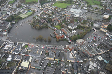
There are many areas, including towns and cities, that are already at risk from periodic flooding. The effects of climate change, such as more severe rainfall events and rising sea levels, will exacerbate risks and put areas at risk that may not have flooded in the past. Thus, it has become vital to study flood behaviours, risks, and consequences. Our team uses hydrologic/hydraulic modelling to investigate the relationship between rainfall, runoff, and flooding.
When appraising flood potential and the risks within particular areas (e.g. flood plains), we often apply hydraulic and hydrologic data modelling to examine meteorological and river flow data. Hydraulic modelling analyses the performance and design of infrastructure such as bridges, stormwater infrastructure and wastewater systems during a potential flood event. Commonly, a hydraulic analysis uses computer modelling software to represent the surrounding ecosystems – the terrain, structure, river and water flow. Through our studies, clients can understand flood risk and develop robust flood mitigation measures. We apply computational flood modelling to support spatial planning, risk assessment, management and the development of flood risk management (FRM) schemes. We also use Hydraulic modelling in 1D, 2D and linked 1D-2D to better understand coastal, pluvial, fluvial, drainage networks.
We use hydromorphology (or fluvial geomorphology) to investigate potential impacts of watercourses on landform over time. These can include possible erosion/scour, sediment transport and deposition. As man-made construction can affect the hydromorphological watercourse regime - assessing any potential impacts on the proposed scheme or development is crucial for success.
We use fluvial geomorphology to inform and guide a variety of projects:
- Construction
- River restoration
- Sediment transport
- Hydraulic modelling
- Natural Flood Management (NFM)
Hydromorphology can play a role in appraising Natural Flood Management (NFM). Nature-based solutions for flooding can be as simple as restoring a river to a meandering path, widening or deepening a river, adding wetlands, woodlands and heaths or introducing soft engineering works (woody debris dams). Our in-depth knowledge of river hydromorphology and geomorphological dynamics assists clients in risk assessments, informs the environmental impact process, helps alleviate flooding impacts, and informs instream flow requirements, system restoration, and ecology.
Ayesa provides flood risk services to public and private sector clients in the public and private sectors. We work with local authorities such as the OPW in Ireland to deliver key flood relief schemes. Our projects range from large flood relief schemes or one-off site assessments for developers.
Expertise In-Depth:
• Geomorphology Assessment
• Ground Investigations and Surveys (GIS)
• Hydrodynamic modelling & assessment
• Hydraulic modelling in 1D, 2D and linked 1D-2D for coastal, pluvial, fluvial, drainage network
• Hydrological studies
• Hydromorphology assessment
• Natural flood risk management measures
• River modelling
• Surface water modelling
• Sediment transport


.png)


